Draft engineering reports and flood maps from the provincial Drumheller flood study were published on Monday, November 30 by the Government of Alberta, and they are asking the public for feedback.
The main focus of this engagement is to receive technical feedback on the draft reports and maps, however, the Ministry of Environment and Parks will consider any feedback received.
“Public engagement is an important part of our study finalization process,” said Jason Penner, communications advisor for Alberta Environment and Parks. “This is an opportunity for the public to review our work and provide feedback regarding factual errors or omissions to help ensure the study is technically sound. More generally, this is also an opportunity for residents to learn more about how flood maps are created for their community, and understand the value of flood maps in improving public safety.”
Drumheller’s flood study was one of 21 studies conducted by the province across more than 60 municipalities over the last year.
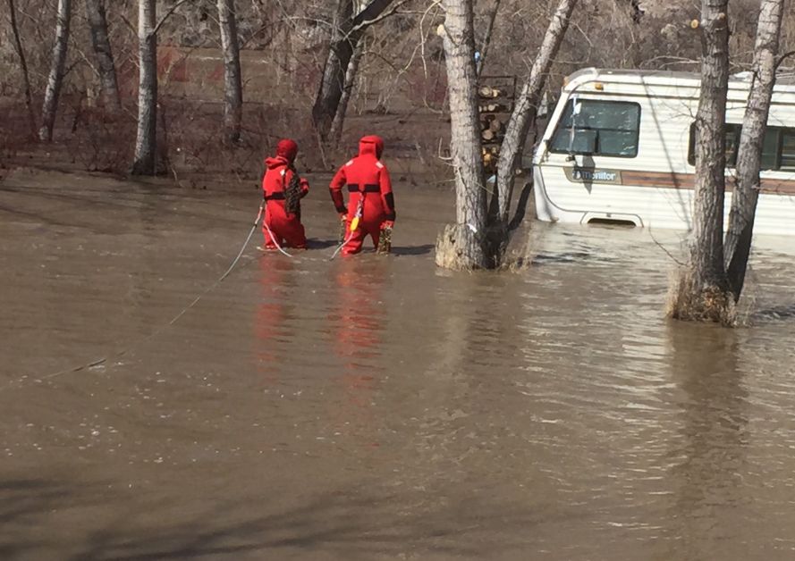
The local study began in the spring of 2018 and was completed in the spring of this year. Data from the April 2018 flood was collected and used to calibrate hydraulic models used to simulate open water flooding of the Red Deer and Rosebud rivers and their tributaries, to ensure accuracy.
In total, 56 kilometres of the Red Deer River, 10 kilometres of the Rosebud River, along with Kneehills Creek, Michichi Creek, and Willow Creek tributaries were assessed in the provincial study.
“We understand Drumheller and its residents are working hard to improve flood resiliency,” Penner added. “Some of the draft information from the new study has already been shared with and considered by Drumheller as part of its ongoing flood mitigation efforts (between October 2019 and May 2020). Designs for new flood berms may consider additional information from the study as we move through the study finalization process.”
The reports from the two-year study are detailed and technical, and each are more than 100 pages in length; those who do not wish to read through the detailed reports can still get involved by viewing the interactive flood map online. Residents can complete the survey by going to alberta.ca/drumheller-flood-study-engagement
The draft map shows areas of Drumheller which would be affected or protected in 13 different flood events.
This is the first phase of engagement and is open to the public until January 15, 2021. Future engagements are planned for 2021.