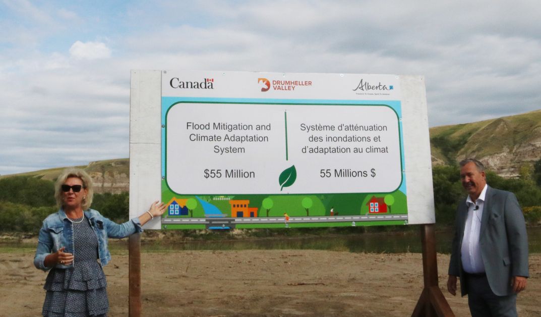
The Resiliency and Flood Mitigation office is continuing work on the design phase of the project and hopes to have a working document in their hands in the near future.
Many residents are asking what the project will look like and how it will affect them.
Chief Resiliency and Flood Mitigation officer, Darwin Durnie, says while they have been in contact with many landowners, they are waiting on the designs to move forward.
“We are preparing 95 per cent complete design drawings that we can use to contact landowners that we will need their land to protect them and their neighbours,” he said. “We’re creating sketches of their property that show the impact of the land taking and preparing value appraisals to try to define what the values of our offers will be.”
Because these are sensitive negotiations, he says they are respecting the confidentiality of homeowners as they deal with these decisions. These are one-on-one meetings, and so far they have had about 80 of these.
Durnie said originally, they were hoping to have these designs in April, but they have been delayed. Like many projects, the flood mitigation program in the valley has felt the pandemic, making it difficult to have site meetings and work collaboratively on plans and documents.
The regulatory process has also been time-consuming. They are dealing with more than 50 agencies whereby they have to get approvals. There are both federal and provincial, everything from Fisheries and Oceans to historical and palaeontological resources.
“We have been working really hard with the regulators to work with them based on long-standing relationships with them to be able to accelerate the process,” he said.
Another time-consuming effort by the office is making a case to the province to use regulated flow rather than the natural flow as a benchmark for the flood mitigation project.
There is no certain timeline for the completion of the design work.
He says the project is a collective effort to protect the community.
“We talk about the need for this is to ensure property value is maintained with regards to insurance now and in the future, and that translates into the ability to get a mortgage. Some of the interactions I have had with folks, some along the river say ‘I’m okay if I get flooded out and stand on my own without insurance.’ I say, ‘Okay but I’m not sure if your neighbours are, two blocks inwards.’”
Durnie explains the project will proceed as they receive approvals and secure land. One portion of the plan to proceed with early is dike work near Rosedale between the Rosebud River and the wastewater treatment plant.
“We are using that as our test case with all the regulatory agencies,” he said, “to see if we can get everybody signing off on this.”
One fear of some landowners is the possibility of hiking trails along the length of the mitigation. Durnie says there will be segments that would be paved, and in the future, there could be more use of the areas.
“Public infrastructure, paid for by public money, should have public access. I don’t think Drumheller can afford to build as much trails as people think, but we can’t handcuff a future council,” he said. “There will be segments of the trail in highly public areas that will have a hard surface.