The Village of Carbon has once again shown its resiliency in the face of adversity.
Despite the high water levels of the Kneehill Creek that runs through the Carbon Valley, only a couple of homes were close to getting flooded with water damage. Temporary berms were made to help mitigate the chances of flooding.
Carbon Mayor Guss Nash explained that the lift station was an area that needed help and has since been sandbagged for protection.
“Our big concern was our lift station for the waste water and we had that protected, [the water] never reached that,” he said. “Unfortunately we did lose parts of our hiking trails and our big suspension bridge across the creek but we really won’t know the amount of damage done to our campgrounds until the water recedes.”
The mayor commends everyone for doing their part in this time of need.
“All in all considering, our CAO, Director of Emergency Management at the fire department, the county and volunteers has assisted us so everybody has pulled together. We are getting through this with minimal damage considering the amount of water,” said Nash. “Our Public Works has been working overtime and they are well coordinated and what a great job they did too so it’s been a whole team effort here in Carbon. It has paid off.”

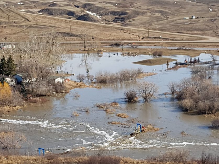
The suspension bridge that once hovered over the Kneehill Creek has since been submerged by the high water levels on Tuesday, April 24. The Carbon Campground area had the most water pooling out of the Kneehill Creek. Photos courtesy of H. Laffin
Alberta Transportation and Public Works responded immediately to an ice dam that had burst in the coulee which flooded Main Street and parts of Highway 836.
“Up in the coulee there are springs that keep feeding all winter and then the ice builds up so when the thaw comes we have a big ice dam up there and it let’s go,” explained Nash.
“When living along the creek you have to be prepared if things happen, but fortunately we have the right people in the right places so special thanks to them.”